


 By Staff
April 16th, 2018
BURLINGTON, ON
Conservation Halton advises that the passage of the low pressure system that has brought the prolonged Freezing Rain/Ice pellets to the area has also brought very strong sustained winds and wind gusts (sustained winds >50 km/hr with wind gusts >70km/hr at Burlington).
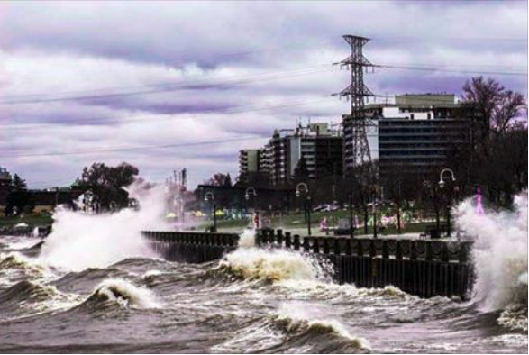
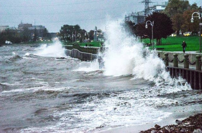
Storm waves
These winds have been steady from the North-East, and therefore the region is experiencing surge wave heights of upwards of 3 to 4 metres. Winds and waves are forecasted to be high throughout the overnight period and into tomorrow morning, and will lessen with the passage of the low pressure centre. With these observed and forecasted wave heights and wind gusts, there is the potential for shoreline flooding and erosion hazards.
There have been reports from other jurisdictions in the western part of Lake Ontario of a combination of shoreline flooding and erosion. While Conservation Halton has not received any reports of shoreline flooding/erosion, municipalities, emergency services and individual landowners in flood-prone areas should be on alert.
Rogue waves breaching the break wall.
Conservation Halton is asking all residents and children to keep a safe distance from locations in proximity to the shoreline. Elevated water levels, high sustained winds and gusts, and the potential for rogue waves to overtop breakwalls and other shoreline structures continue to make these locations extremely dangerous. Please alert children in your care of these imminent dangers.
Conservation Halton will continue to monitor the open-water lake and weather conditions and will issue further messages as necessary.
This Flood Outlook Statement will be in effect through Tuesday April 17th, 2018.
Note: A Watershed Conditions Statement – Flood Outlook is issued as an early notice of the potential for flooding based on weather forecast of heavy rain, snow melt, high wind or other conditions that could lead to high runoff, ice jams, shoreline flooding or erosion.