


 By Pepper Parr
August 20, 2015
BURLINGTON, ON
Part two of a two part feature on how the Conservation Authority explains The Flood.
There are no streamflow gauges located along Roseland Creek, Tuck Creek, Shoreacres Creek, and Appleby Creek. Flow rates for the event were estimated by comparing high water marks that resulted from the storm event with other data.
Crews from Conservation Halton conducted field investigations during the week following the storm. They identified locations of high water marks and debris lines at the upstream and downstream sides of culvert and bridge crossings, through parks and other public lands, and on private properties where permission had been provided.

The 407 became a catch basin for the water cascading down from the Escarpment creeks.
The rainfall totals are higher in the sections of the watersheds upstream of the QEW than rainfall totals downstream of the QEW. This generated a trend of decreasing flow rates relative to return period flows where considerable storage and flow attenuation was available within creek and valley areas upstream of road and railway crossings.
Runoff rates generated by the storm are a function of both total rainfall, and rainfall intensities. Generally, average watershed rainfall totals are higher than 100 year values used in the computer simulation models, and less than the Regional (Hurricane Hazel)
August 4th, 2014 rainfall intensities, for short durations, are approximately equal to the 100 year event.
Generally, estimated flow rates are less than the computer simulated and higher than or equal to the 100 year simulated values.
The areas of most significant impacts associated with riverine/flood plain flooding are located in portions of the City of Burlington that were developed prior to the application of Provincial and Conservation Authority flood plain planning policies. Areas in which these policies were applied as part of the development process experienced significantly less erosion and flood damages demonstrating their effectiveness.
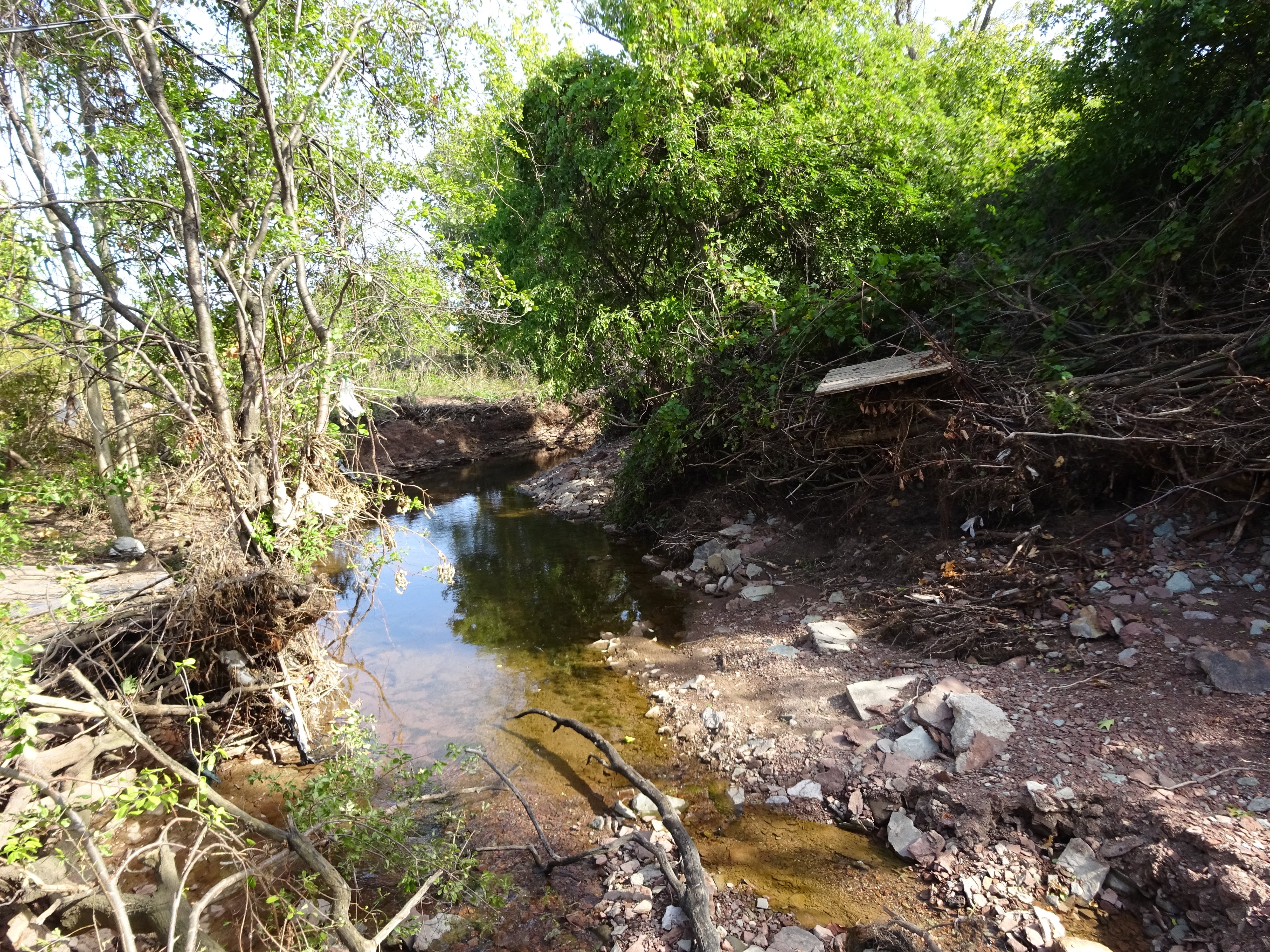
Tuck Creek days after the rain had stopped.
The Hager-Rambo Diversion Channel afforded a significant level of protection during the event for those portions of the City below the channel, south of Fairview Street and east of QEW Niagara to Drury Lane. Conservation Halton staff received reports that the diversion channel was flowing near capacity. Staff also received reports of the Upper East Rambo Creek spilling along the CNR (Halton) tracks from the East Rambo Pond (north of the QEW/403) and flooding several properties along Plains Road.
 The Conservation Authority says:
An investigation should be conducted in partnership with the City of Burlington to determine what mitigation measures can be implemented to reduce future riverine flood damages along Tuck Creek upstream and downstream of New Street.
An investigation should be conducted in partnership with the City of Burlington to determine the extent of runoff diverted from Shoreacres Creek into Tuck Creek at Highway 407 during the August 4th, 2014 storm event. Also, the investigation should determine what mitigation measures could be constructed to prevent or reduce any future spills from Shoreacres Creek into Tuck Creek in this location.
An assessment should be conducted in partnership with the Regional Municipality of Halton and the City of Burlington to inventory the number and location of telemetered rainfall and streamflow gauges within their respective networks to identify potential gaps.
Expansions to the networks should be undertaken in a collaborative and coordinated manner to facilitate data sharing and enhance flood forecasting and emergency response capabilities within the City of Burlington. These improvements will help to better equip all agencies to respond to similar events in the future as more frequent short intense storms are expected as a result of a changing climate.
Consideration should be given to updating the watershed studies for Roseland, Tuck, Shoreacres, Appleby and Sheldon Creeks in an effort to explore opportunities to reduce storm runoff rates and volumes.
To the absolute amazement of the Conservation people was the fact that the storm, which was in fact three separate storms, came in from the northj west and hovered over three different creeks from approximately 1:15 pm to about 9:00 pm.
The two closest water depth collectors were to the east and the west of the storm – the data from those two devices normally tell the environmental staff at Conservation Halton what is going on but there wasn’t any significant rainfall outside the narrow SIZE band of the storm.
From a data point of view – there was nothing abnormal – which wasn’t the way people south of the 407 who were experiencing the storm saw things.
The data from the collectors basically said – there was no rainfall here.
Part one of a two part feature on how the Conservation Authority explains The Flood

Discover more from Burlington Gazette - Local News, Politics, Community
Subscribe to get the latest posts sent to your email.
